


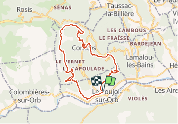

11.3 km | 20 km-effort


User


FREE GPS app for hiking
 SityTrail
IGN / Geographical institutes
SityTrail World
The world is yours!
Trail Walking of 17.4 km to be discovered at Occitania, Hérault, Le Poujol-sur-Orb. This trail is proposed by RandoVal.
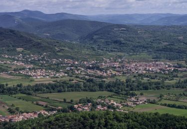
Boucle dans les Hauts-Cantons près du Caroux. Départ et stationnement près de la voie verte au Poujol-sur-Orb. Préférer le sens horaire, belle montée jusqu'aux tombes mégalithiques, passage au mémorial des Écrivains Combattants.

Walking

Walking

Walking

Walking

Walking

Walking

On foot

On foot